• Accessibility
Menu Close
  • NYC Skyline

How to Travel around New York State from NYC

New York State's vacation regions are closer than you may think

Turn one vacation into two or more! It's easy to travel to New York's other vacation regions from NYC. Regions like Long Island and Hudson Valley are the quickest city escapes and you don't even need a car! Stay overnight to get the true feel for each area, whether you're staying in a quaint bed & breakfast on a lake, a hotel with an awesome view, or camping in the fresh air of the mountains. Plus, MTA AWAY offers a variety of deals and packages at museums, beaches, hotels, and more, so you can make the most out of your excursion. On a longer escape, explore the award-winning wineries of the Finger Lakes, enjoy farm-to-table cuisine in the Catskills, experience the stunning natural beauty of the Adirondacks, or cross off Niagara Falls from your bucket list. Plus, MTA AWAY offers a variety of deals and packages at museums, beaches, hotels, and more, so you can make the most out of your excursion.

Read More

NYC to LI Map

How to get to Long Island from NYC

BY TRAIN: The Long Island Railroad (LIRR) has hourly service to and from New York City’s Penn Station and Grand Central Terminal. Check the website for schedules at mta.info/lirr. Bundle and save when you book with MTA AWAY, offering discounted train tickets, attraction admission, transportation to and from the station, and more to destinations like Fire Island, Splish Splash Water Park, and historic Gold Coast Mansions.   

BY CAR: On-site car rentals are available at Long Island MacArthur Airport and select LIRR stations, as well as taxis and rideshares. Travelers can also opt to rent a car and drive to Long Island from New York City, about a 30-minute to three-hour drive depending on destination.

NYC to Hudson Valley Map


How to get to Hudson Valley from NYC

BY TRAIN: Travelers can take Metro-North Railroad from Grand Central Station to the Hudson Valley. For information on station stops and schedules visit mta.info/mnr. Bundle and save when you book with MTA AWAY, offering discounted train tickets, attraction admission, transportation to and from the station, and more to destinations like Bannerman Castle, Dia Beacon, and Playland Park

BY CAR: On-site car rentals are available at select Metro-North stations, as well as taxis and rideshares. Travelers can also opt to rent a car and drive to the Hudson Valley from New York City, which is about an hour to three-hour drive depending on destination.

NYC to Catskills Map


How to get to the Catskills from NYC

BY TRAIN: Amtrak and Metro-North both service numerous stops along the Hudson River, after which you'll need to rent a car or take a taxi to get to your final destination. For information on station stops and schedules visit mta.info/mnr or amtrak.com.

BY CAR: On-site car rentals are available at select local train stations. Travelers can also opt to rent a car and drive to the Catskills from New York City which is about a two- to four-hour drive depending on destination.


NYC to Capital-Saratoga Map

How to get to Capital-Saratoga from NYC

BY PLANE: Travelers can fly direct from Newark or Laguardia Airport into Albany International Airport, which offers flights through airlines like JetBlue, Delta, and Southwest. For more information on flight schedules and service offered visit albanyairport.com.

BY TRAIN: Hop on an Amtrak train from New York City’s Penn Station and travel along the Hudson River to Albany, Schenectady, or Saratoga. Amtrak stops at a number of towns in this region, visit amtrak.com to find out about schedules and ticketing.

BY CAR: On-site car rentals are available at Albany International Airport or at local Amtrak stations, or travelers can rent a car and drive to the Capital-Saratoga region from New York City, about a two-and-a-half-hour to four-hour drive depending on destination.


NYC to Adirondacks Map

How to get to the Adirondacks from NYC

BY CAR: On-site car rentals are available at the Albany International Airport or Amtrak stations. Travelers can drive to the Adirondacks region from New York City, which is about a four- to six-hour drive depending on destination.

BY TRAIN: Travelers can board an Amtrak train in New York City’s Penn Station for a number of stops through the region. Visit amtrak.com to find out about schedules and ticketing.

BY PLANE: Fly direct from Newark or Laguardia Airport into Albany International Airport, just outside of the region, offering flights through airlines like JetBlue, Delta, and Southwest. For more information on flight schedules and services visit albanyairport.com. Limited flight service is also offered at Plattsburgh International Airport, located in the Adirondacks, visit flyplattsburgh.com. Montreal's and Burlington, Vermont's airports are also within driving distance of the region.


NYC to Thousand Islands-Seaway Map

How to get to the Thousand Islands-Seaway from NYC

BY PLANE: Traveling to the region from New York City is easiest by flying directly into Syracuse Hancock International Airport, renting a car, and driving into the region. For more information on flight schedules and car rentals visit syrairport.org. Watertown International Airport also offers limited air service directly into the region, visit watertownairport.com for more information.

BY CAR: On-site car rentals are available at both the Watertown International Airport and Syracuse Hancock International Airport.

BY TRAIN: Travelers can also opt to take an Amtrak from New York City’s Penn Station to Syracuse (a six- to seven-hour ride) and rent a car and drive to the Thousand Islands region, which is about a 90-minute drive. For more information, visit amtrak.com.

NYC to Central NY Map

How to get to Central NY from NYC

BY PLANE: Travelers can opt to fly directly to Syracuse Hancock International Airport (syrairport.org) from New York City and rent a car to get to the region or travel from Newark or Laguardia Airport to Albany International Airport (albanyairport.com), which is just outside of the region and a short car ride away.

BY CAR: On-site car rentals are available at Syracuse Hancock International Airport or at local Amtrak stations.

BY TRAIN: Travelers can choose to take an Amtrak train to Albany from New York City’s Penn Station and rent a car and drive to the region, which is about an hour to two-hour drive, depending on destination. For more information on schedules and ticketing, visit amtrak.com.


NYC to Finger Lakes Map

How to get to the Finger Lakes from NYC

BY PLANE: The easiest way to get to the Finger Lakes from New York City is flying directly into Greater Rochester International Airport, which is about an hour plane ride and offers flights through JetBlue and Delta airlines, or directly into Syracuse Hancock International Airport. For more information on flight schedules and service, visit rocairport.com.

BY CAR: On-site car rentals are available at Syracuse Hancock International Airport and Greater Rochester International or at local Amtrak stations.

BY TRAIN: Travelers can take an Amtrak train to Syracuse or Rochester, which has station stops in the region. For more information on schedules and ticketing, visit amtrak.com.


NYC to Greater Niagara Map

How to get to Greater Niagara from NYC

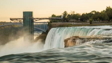
BY PLANE: The best way to get to the Greater Niagara region from New York City is flying directly into Buffalo Niagara International Airport, which is just over an hour plane ride and offers flights through JetBlue and Delta airlines. For more information on flight schedules and service, visit buffaloairport.com.

BY CAR: On-site car rentals are available at Buffalo Niagara International Airport or at local Amtrak stations.

BY TRAIN: Travelers can take an Amtrak train to Buffalo and Niagara Falls, which has station stops in the region. For more information on schedules and ticketing, visit amtrak.com.


NYC to Chautauqua-Allegheny Map

How to get to Chautauqua-Allegheny from NYC

BY PLANE: The easiest way to get to this region from NYC is flying directly into Buffalo Niagara International Airport, just over an hour plane ride and offers flights through JetBlue and Delta airlines. Travelers should then rent a car and drive to the region, which is about an hour to two-hour drive depending on destination. For more information on flight schedules and service, visit buffaloairport.com.

BY CAR: On-site car rentals are available at Buffalo Niagara International Airport or at local Amtrak stations.

BY TRAIN: The nearest train station to the region is the Buffalo Amtrak Station, which is about an hour drive away from the region. For more information on schedules and ticketing, visit amtrak.com.


How to Get Around NYC map

How to get around NYC

BY SUBWAY: The quickest way to get around New York City is by hopping on the subway, offering service throughout Manhattan, Brooklyn, The Bronx, and Queens. Most subway stations are within walking distance of major attractions and offer tap to pay with contactless credit/debit card, and smartphone via OMNY, or pay with a MetroCard. For more information, visit new.mta.info.   

BY BUS: MTA buses offer an easy and accessible way to navigate New York City’s five boroughs. There are several bus options, offering local service, express service throughout the boroughs, and more. All MTA buses are accessible for wheelchair users and can be boarded using OMNY, MetroCard, coins, or SingleRide tickets. For more information visit, new.mta.info.

BY TRAIN: Metro-North and the LIRR are also great options for getting around the city. Metro-North makes stops throughout The Bronx, such as Yankee Stadium and the New York Botanical Garden. For more information visit, new.mta.info.